FLIRT UAV

FLIRT (Flying Intelligence Robotic Tool) is our model range of powerful professional UAVs for aerial mapping, monitoring and other remote sensing applications.
Professional applications
 aerial mapping
 agricultural & forest monitoring
 natural park monitoring
 monitoring of piping & power lines
 aerial reconnai- ssance
 emergencies
 surveillance & security
FLIRT UAV solutions combine the advantages of unmanned flying systems with high standards of piloted specialized aircrafts. The defining feature of our UAVs (unlike many others) is its ability to get series of well-aligned images even in a strong crosswind.
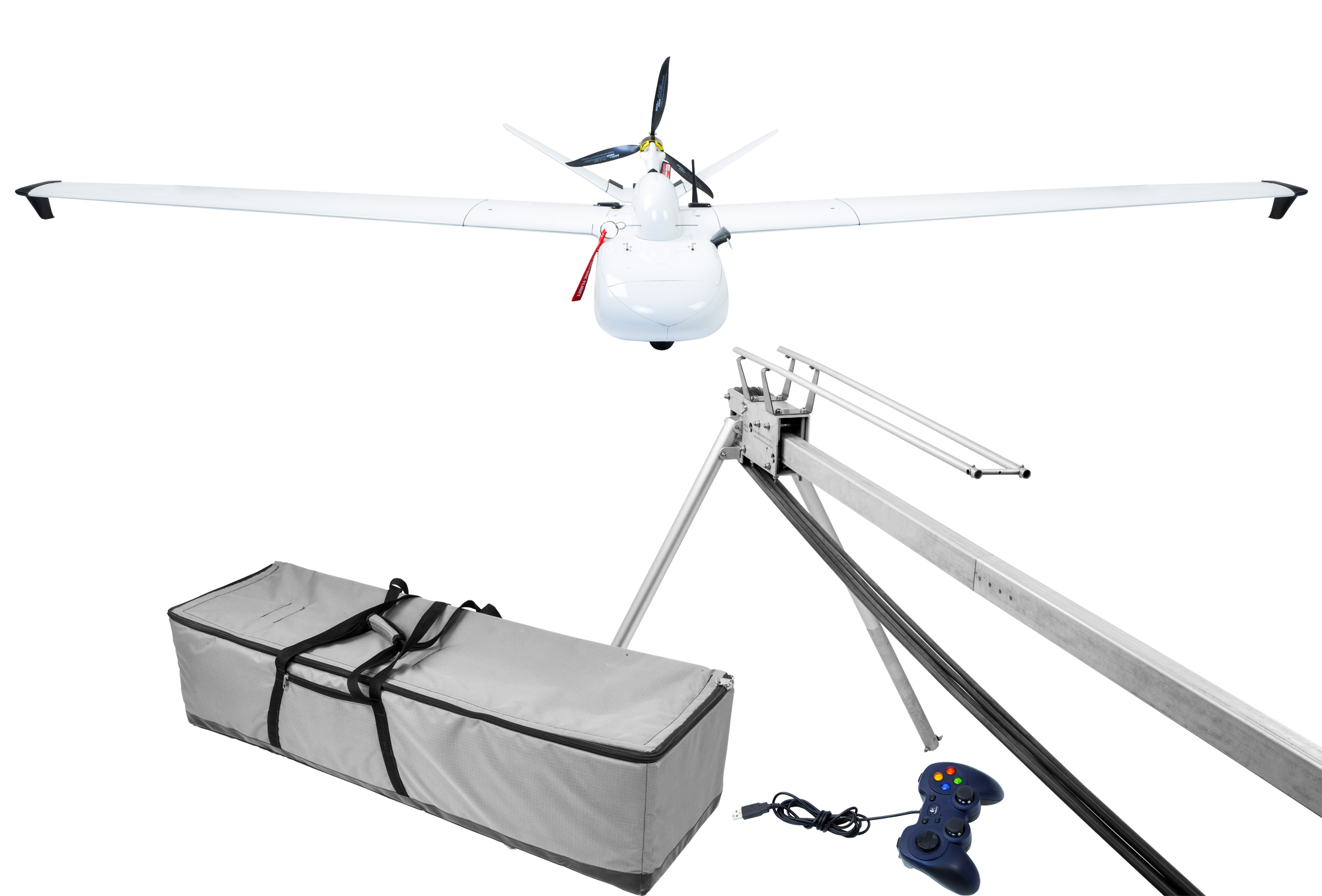
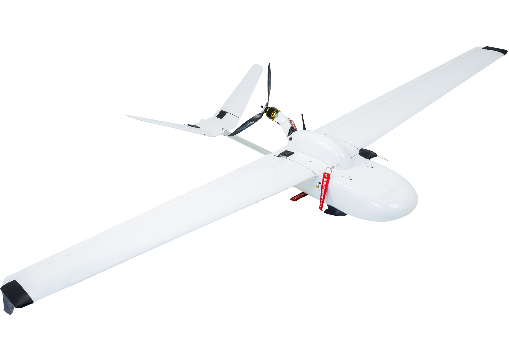
FLIRT Arrow
Arrow is a light-weight, hand-launchable model is specifically designed for aerial mapping, intelligence and video surveillance.
Use cases
security
emergencies
monitoring of piping & power lines
agricultural & forest monitoring
natural park monitoring
 intelligence
aerial mapping
intelligence
aerial mapping
FLIRT Cetus
Cetus is a highly-specialized aircraft designed for high precision aerial mapping of vast areas. Stabilized camera with full-frame sensor combined with great flight duration allows you to capture extremely big territories in single flight.
Use cases
aerial mapping
agricultural & forest monitoring
natural park monitoring
monitoring of piping & power lines
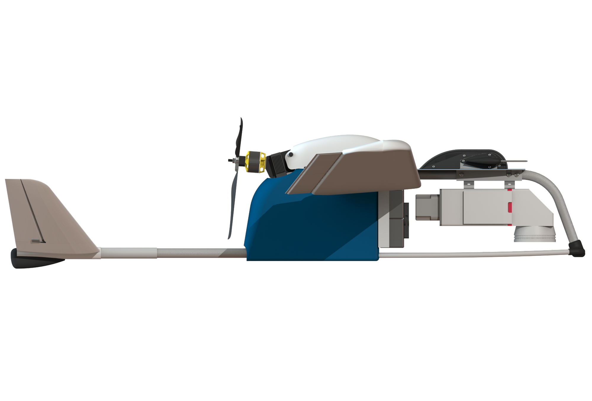
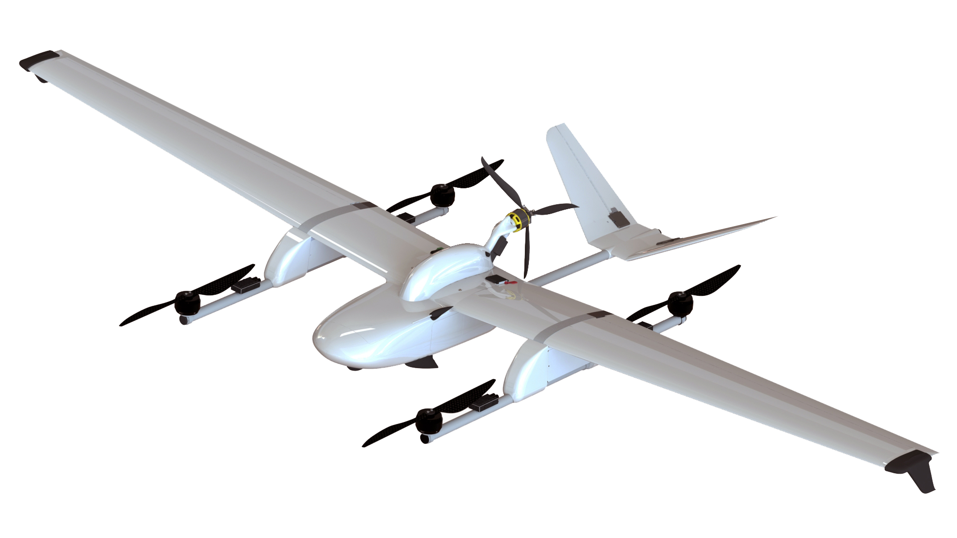
FLIRT Iron
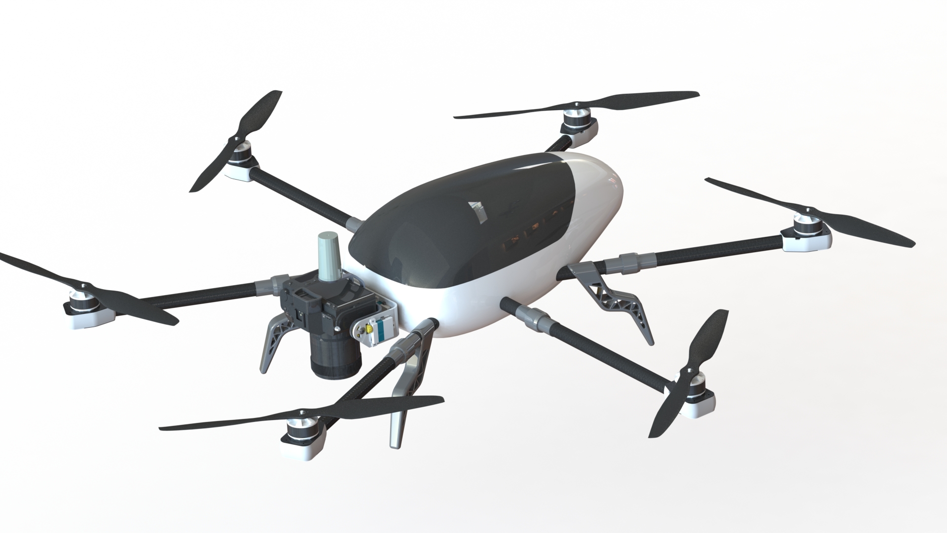
Iron is a unique model that combines speed and flight distances of fixed-wing systems with 360-degree overview for cameras, LIDAR and other big-size equipment, as in multicopters. Durable metal & fabric construction makes Iron almost indestructible.
Use cases
aerial mapping
agricultural monitoring
monitoring of piping & power lines
 LIDAR scanning
 oblique camera capturing
FLIRT Falcon
FLIRT Falcon was specially designed for professional industrial cameras and LIDAR scanners.
Use cases
LIDAR scanning
monitoring of piping & power lines
aerial mapping
natural park monitoring
agricultural & forest monitoring
FLIRT Beetle
Lightweight, fully automatic and versatile Beetle delivers ultra-high detail and accuracy
Use cases
security
emergencies
monitoring of piping & power lines
agricultural & forest monitoring
natural park monitoring
aerial mapping
VTOL module
Additionally Arrow & Cetus models can be provided with VTOL (vertical take-off / landing) modules for missions with limited operational area. Flights under the VTOL mode are completely automated from start to finish and the missions for them are created by the FlightPlanner.